NH Method
The Method for Inventorying and Evaluating Freshwater Wetlands in New Hampshire (NH Method)
Provides communities, conservation groups and professionals a practical method for evaluating wetland functions.
Originally published in 1991, the NH Method was revised in 2011 and in 2015. In April 2023, the NH Method was edited to include updated hyperlinks and using GRANITView with the new Wetlands Mapping Tools to generate maps and data to answer questions in the NH Method.
The Method for Inventorying and Evaluating Freshwater Wetlands in New Hampshire (NH Method) provides a wetland evaluation method for use by public officials and community volunteers, professionals with some familiarity with wetlands,
but who are not wetland specialists, and professional wetland scientists.


Mapping Wetlands
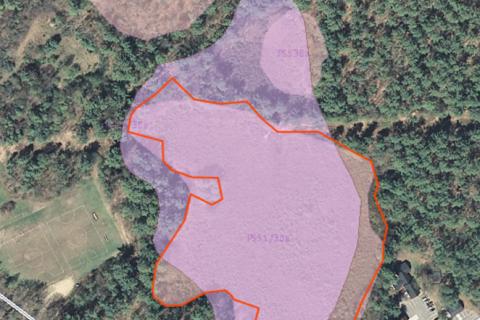
April 2023 UPDATE: The NH Wetlands Mapper has been retired. Users should now use the GRANITView Online Mapper, which many of you are already using. GRANITView includes all the data layers needed to answer the questions in the NH Method. It now also includes a new Custom tool, Wetland Mapping Tools, specifically developed for users of the NH Method. The wetland mapping tools include the ability to draw wetland and watershed boundaries, which includes automatic calculation of the acreages of each. It also includes a "Buffer tool" allowing the user to show the 500 ft zone around the wetland, or any other width that is needed.
