Appendix A
4/26/23: Appendix A has been deleted from the NH Method, since it is no longer relevant. All the current references are embedded in the NH Method documents as updated hyperlinks.
Appendix B
Instructions for Answering Questions Using the NH Wetlands Mapper
(PDF)
Instructions for Answering Questions Using the NH Wetlands Mapper
(Word document for editing)
GRANITView (updated with Wetland Mapping Tools 4/2023)
Appendix C
Instructions for Answering Questions Using GIS (PDF)
Instructions for Answering Questions Using GIS (Word Document for editing)
Appendix D
Wetland Soils Tables (NRCS data) for Function 10 (PDF)
Appendix E
Sample Application of the NH Method (PDF)
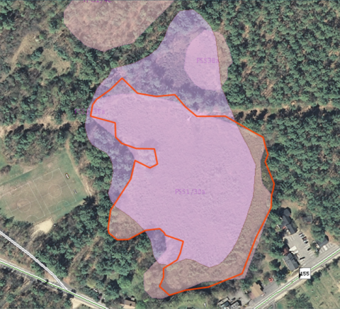
Sample Wetland Maps (12) (PDF)
Appendix B Completed for Sample Wetland (PDF)
Appendix F
Cowardin System of Wetland Classification (1979) and the National Wetlands Inventory (PDF 963 KB)
Appendix G
Interpreting Topographic Maps and Drawing Watershed Boundaries (PDF 708 KB)
Appendix H
Identifying Wetlands For Restoration Using the NH Method and NH Wetlands Mapper (PDF 140 KB)
Appendix I
Summary of Questions to Answer in the Field (PDF 270 KB)
Published by
University of New Hampshire Cooperative Extension