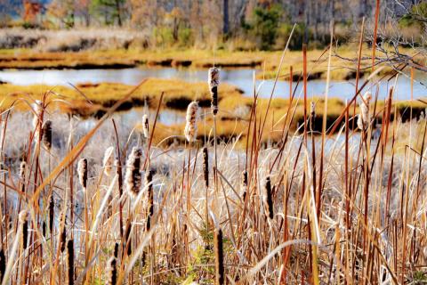
Credit for Going Green
The UNH Stormwater Center co-created to help New Hampshire communities meet water quality standards through the use of buffers. Project engaged a panel of experts to generate science-based recommendations for calculating the pollutant removal rate of restored or constructed buffers in development, redevelopment, and restoration projects, and others involving land use change. Communities can now use this information to receive pollutant removal credits under permits issued by the NPDES Stormwater Permit Program. Municipal staff and boards can promote these recommendations as a way to protect water quality, while achieving other benefits like habitat provision and flood mitigation. The project was sponsored by the National Estuarine Research Reserve System Science Collaborative.
- Access an outreach toolkit to support sharing this project’s results and process
- A technical memorandum that summarizes panel’s results
- A non-technical summary of the panel’s results
- A summary of the panel process
- A guide to the expert panel process
NHDES Pollutant Tracking and Accounting Project (PTAP)
We are excited to announce that the PTAP database is now live with several enhanced features. In addition to the existing annual reporting and accounting summaries we have created an export csv that can be imported directly into the BMP Accounting and Tracking Tool (BATT) which is EPA Region 1 accounting preference. We have also added nonstructural BMP tracking and export csv tools for the BATT as well.
If you haven't identified a municipal (town) administrator yet send us your nominee and we will set up an account for them. The purpose for a town administrator is to review, edit and approve submittals for projects in your municipality.
Database Access
PTAP online database
If you are a PTAP municipal partner
PTAP Participant Instructions
If you need detailed instructions
PTAP Database Instructions
For crediting and annual report development PTAP is employing the EPA Region 1 BMP Accounting and Tracking Tool (BATT)
BATT Download
If you have any questions please contact Sally Soule: Sally.Soule@des.nh.gov or James Houle: james.houle@unh.edu
Project Description
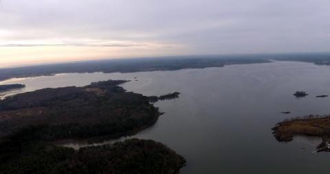
The Great Bay estuary and its tributaries are becoming increasingly polluted (PREP, 2013, DES, 2014). Due to declining water quality in Great Bay and other water bodies, Great Bay watershed communities currently face regulatory requirements to improve water quality such as Administrative Orders of Consent and MS4 stormwater permits. These requirements necessitate tracking of NPS control projects designed to mitigate and reduce pollutants entering Great Bay and accounting for the pollutant load reductions achieve. The majority of pollutants in the bay originate from sources of pollution spread across the watershed rather than municipal wastewater treatment facilities. These sources of pollution are called non-point sources of pollution (NPS) and consist of septic systems, fertilizers and air pollution (PREP, 2013, DES, 2014). Stormwater from impervious cover (IC), such as roads and parking lots, is a major pathway for NPS pollutants.
Tracking and accounting for pollutant load reductions achieved through various NPS control projects is challenging. Some communities have initiated steps to develop tracking systems; however, regional consensus has not been reached on accounting or tracking methods. Communities in the region agree that regional coordination on tracking and accounting is needed and would be beneficial; however, implementation resources are limited.
This project will result in the creation of guidelines and recommendations for tracking and accounting systems and identify potential tools that will enable municipalities to perform a quantitative assessment of pollutant load reductions associated with nonpoint source management activities in the Great Bay region.
SNEP Network
UNHSC is part of a technical team of service providers headed by the New England Environmental Finance Center. The SNEP Network provides training and assistance to municipalities, organizations, and tribes to advance stormwater and watershed management, ecological restoration, and climate resilience in Rhode Island and Massachusetts. The network is committed to building capacity in conjunction with EPA’s Southeast New England Program within EPA Region 1.
Clean Sweep Project
Clean Sweep Project, which used an expert panel process to develop consensus-based recommendations to modify pollutant load reductions for street cleaning BMPs in ways supported by existing science and data. The project was modeled after Credit for Going Green, a similar initiative that used techniques from the Chesapeake Bay to develop pollutant reduction
performance curves for using restored or constructed buffers to meet in-stream pollution reduction targets. Clean Sweep is sponsored by the U.S. Environmental Protection Agency, the Piscataqua Region Estuaries Partnership, and the Town of Durham, New Hampshire. The project
team gratefully acknowledges the contributions of time and expertise from members of the expert panel and advisory committee.
Clean Sweep Tech Memo & Outreach Toolkit Developed
We are very happy to share the final version of the Clean Sweep Technical Memo. Please disseminate the memo among your professional networks as appropriate. We’ve also created a simple outreach toolkit to support communications about this project. Happy Sweeping!