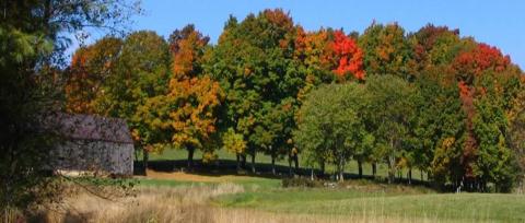
The landscape of an area defines its cultural, natural, and historic heritage. Scenic routes, special landscape features and vistas of all kinds contribute to a community’s character and aesthetic quality. They can also provide tourism-related economic opportunities. Poorly planned development can impact and undermine these resources. Consequently, growth-related problems can have negative effects on communities by threatening their scenic areas. Preserving the integrity of scenic vistas requires consideration of both the area being viewed (the vista) and the point(s) from which it is seen (the viewing area). Identifying the full suite of scenic resources is the first step toward determining areas for protection.
Basic NRI - What to Include:
This information can be included as a Detailed Inventory Study (see below).
Detailed Inventory Studies:
Refer to your town’s master plan which may have specific descriptions of scenic areas or Designated Scenic Roads. Some towns may have already done a Scenic Resources Inventory which could be current or need updating.
The NH Scenic and Cultural Byways Program, led by the NH Dept. of Transportation (DOT), was established in 1992 under RSA 238:19, "… to provide the opportunity for residents and visitors to travel a system of byways which feature the scenic and cultural qualities of the state…”
The NH Scenic Roads Designation (RSA 231:157) allows the establishment of Scenic Roads. Scenic Roads are substantially different from Scenic and Cultural Byways. These roadways are only recognized locally, cannot be on Class I or II roads, and are not specifically part of a statewide system. Towns may designate Scenic Roads by town meeting vote. Scenic Roads designation requires a public hearing prior to removal of trees in a public road right-of-way and enables municipalities to adopt other regulations.
A comprehensive inventory of scenic resources can start the process of prioritizing and protecting areas with scenic value. Scenic information can be digitized for use in GIS. Local surveys of community residents can provide the work group with a list of popular scenic areas and vantage points that can help detail the scope of the town’s scenic resources. Scenic vistas can be marked by numbered point locations that correspond to numbered sites listed in an accompanying descriptive table. Designated Scenic Roads and Scenic and Cultural Byways can be shown by highlighting the appropriate section of road on the map. Photographs of scenic vistas can be documented in the report that accompanies the inventory maps. The work group should determine the most appropriate criteria for assessing local scenic values and fully document the methods used.
Additional Resources:
Review existing community NRI's (open the NRI menu) - Scenic Resources Sections
Holden, Maine Scenic Resources Study (2011) provides a detailed study of scenic resources including an assessment of scenic areas.