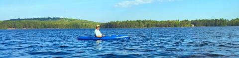
New Hampshire is well known for the quality and variety of its recreational resources, such as hiking trails, camping areas, trout streams, mountains, whitewater, ski areas, canoeing and kayaking (lakes, ponds, streams and wetlands with open water). Public lands such as the White Mountains National Forest, state parks, and town forests provide important recreational opportunities. With much land in private ownership, many landowners allow the public to access and use their land for recreational purposes, e.g., snowmobile and hiking trails. Land use changes, ownership changes, and misuse of recreational areas can threaten the availability of privately owned land for recreational use. Conversely, the expansion or creation of new conservation areas can expand access to public and private lands, provide new recreational opportunities and help general local tourism and economic growth.
Basic NRI - What to Include:
Some communities have mapped local trails - check with your conservation commission and snowmobile association to see if trail maps are available that could be easily incorporated into a Basic Inventory.
Detailed Inventory Studies:
An inventory of recreation areas can be included a tabulated list in the written NRI report and can be shown on a map of publicly accessible conservation land in town. Communities may have a local recreation committee that has documented information about recreation resources and needs. The town’s master plan may include a list of public access points and municipally-owned recreation areas. Check with state and federal agencies to identify public access sites on the community’s rivers, lakes and ponds. While the state has jurisdiction over all bodies of water greater than ten acres, it doesn’t guarantee access to them. A map showing publicly accessible conservation land in town and other recreation areas.
Trails for hiking, skiing and snowmobiling may be maintained by local groups that can supply maps and other information (e.g., snowmobile clubs). The NH Trails Bureau administers multiple-use trails on state, federal, and private lands and assists organizations, municipalities, and trail clubs with the development of trails on both public and private lands Old town roads are often used for recreation, such as Class VI and discontinued roads. Topographic maps and aerial photographs can be used to map their locations. You may wish to record whether these roads are closed to gates and bars, abandoned, or of unknown status. Local fishermen can help to identify popular fishing spots for inclusion in the inventory. GPS can be used to map local trails information - this can be significant undertaking that will require volunteers and other resources.
Additional Resources:
NH Trails Bureau(NH State Parks)
NH Snowmobile Association (Interactive Trails Map)
NH Public Boating Access Map (NH Fish and Game)
List of Public Boating and Fishing Access Sites (NH Fish and Game)
List of Fishing Public Access Sites (NH Fish and Game)
Swimming and Boating in New Hampshire (Stay-Work-Play)
NH Lakes Association (protects NH lakes and their watersheds through education and advocacy