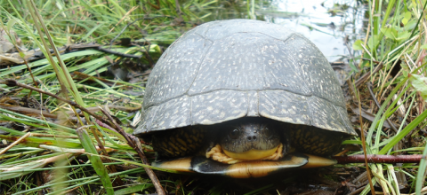
New Hampshire is home to a great diversity of wildlife species, with habitats ranging from coastal islands to alpine tundra. A wildlife habitat inventory is the first step in protecting wildlife in your community. Fragmentation of habitats resulting from poorly planned development reduces the size of habitat blocks and creates barriers to the movement of many terrestrial species. The NH Wildlife Action Plan is the state’s most comprehensive wildlife and habitat assessment and is the primary resource used to compile the Wildlife section of the NRI. The Wildlife Action Plan compiles a vast amount of data, analyzes much of it to assess the threats to species and habitats, and outlines key conservation strategies to help conserve the wildlife and habitats that are most at risk in our state. Originally published in 2005 and updated 2015 by NH Fish & Game Department staff and their conservation partners, the NH Wildlife Action Plan identifies 27 critical habitats and 157 species of greatest conservation need. It provides decision-makers and landowners with important tools for addressing the needs of declining wildlife species and keeping common species common, including restoring and maintaining critical natural habitats.
Basic NRI - What to Include:
Detailed information for compiling the Wildlife Section of the NRI is housed on the Taking Action for Wildlife website - this provides guidance and resources for putting together the wildlife section of the NRI. This information is based on data from the 2015 NH Wildlife Action Plan. Refer to Section 4 of the Sample NRI Outline for a framework for the Wildlife Chapter of the NRI.
It is important to factor in threats to wildlife and habitats from long-term climatic changes. Severe weather events that are outside of the natural range of variation can potentially alter the composition of species in a given habitat as species die or move in response to these changes. Additional threats to wildlife and habitats are posted by increased flooding, increased winter and summer temperatures, changes in the amount and distribution of precipitation, reduced winter conditions, and sea level rise. Further, the human response to these changes such as the building of flood control structures to accommodate more severe precipitation events can also pose a threat to species and habitats. Refer to the Climate Change and Severe Weather section of the NH Wildlife Action Plan (scroll down to the last section of Chapter 4) for more detail. While changes in temperature and precipitation will prompt changes in habitat that will stress some native species of fish and wildlife, there are some actions to take to improve existing habitats. For example, vegetated buffers on river banks and lakeshores can help to offset the negative effects of warming stream temperatures by shading the water and creating cooler areas for coldwater fish like brook trout. Connected natural areas along rivers also form corridors that help animals migrate to more hospitable temperatures or habitats. Protecting key habitats can provide refuges for local wildlife as well as wildlife that may migrate northward.
Basic NRI Maps
A set of two wildlife habitat maps was prepared to display data from the Wildlife Action Plan Tthese maps were most recently updated in 2015. The maps are already compiled in ready-to-use NRI format:
The NH Wildlife Habitat Land Cover Map - shows the distribution of habitats across the state.
The Highest Ranked Wildlife Habitat by Ecological Condition Map - shows the ranking of wildlife habitats based on an analysis of ecological condition using biological, landscape and human impact factors most affecting each habitat type).
The wildlife habitat maps for all NH communities are both available from GRANIT, on the GRANITView Mapper and on the NH Fish & Game Town Maps web page (8.5 x 11 PDF format). Poster size copies of these maps will need to be generated by a GIS provider. See Map examples in the Sample Map set
Detailed Inventory Studies:
Vernal Pools: These are depressional wetlands with a seasonal cycle of flooding and drying. Vernal pools are vulnerable because they are small and often overlooked since they are seasonally dry - this makes them more likely to be filled during development. Some NH communities have inventoried the locations of their vernal pools (e.g. Nelson and Portsmouth) and others have initiated upland buffer protection around vernal pools (e.g. Litchfield). Field checking is needed to inventory vernal pools - their locations can be marked on a map and brief descriptions included in a narrative. Learn more about vernal pools: Volunteers documenting vernal pools in the Monadnock Region of NH (Ashuelot Environmental Observatory); Documenting Vernal Pools Guide (NH Fish and Game); Vernal Pool Habitats (UNH Cooperative Extension); Vernal Pool Habitat Profile (NH Wildlife Action Plan, Appendix B - starts on p159).
Wildlife Species Inventory: Lists of wildlife species may be added to the NRI. This requires field observation to document the species occurring in critical habitats in your community. Use the Community Wildlife Sightings Activity to get input from community members.
- NH Wildlife Action Plan (NH Fish and Game Dept.), updated in 2015, is a comprehensive source of data, maps and information about wildlife and habitats in New Hampshire.
- Taking Action for Wildlife provides resources to help communities, conservation groups and landowners conserve wildlife and habitats in New Hampshire using data and information from NH's Wildlife Action Plan.
- UNH Cooperative Extension Wildlife Resources provides information about wildlife habitats and species in New Hampshire
- NH Habitat Stewardship Brochure Series - This series of twelve brochures are available from UNH Cooperative Extension to help landowners and others learn about and help conserve important wildlife habitats