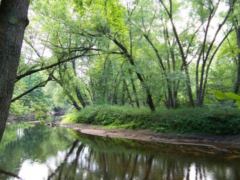
Floodplains are low-lying areas adjacent to streams and other waterbodies that become inundated during heavy precipitation or snowmelt. By slowing and storing floodwaters, floodplains reduce downstream flood damage and provide protection between developed areas and the damaging impacts of floods. Naturally vegetated floodplains help prevent erosion, recharge ground water and can serve as travel corridors for wildlife. These highly productive ecosystems are home to a unique suite of plants and animals that can tolerate occasional flooding. When left in their natural state, floodplains provide space for the fluctuations in flow that cause streams to expand and contract. Floodplains and other streamside (riparian) areas are also where land use change will most easily influence stream quality. With development, paved and other impervious surfaces, such as the roofs of buildings, increase runoff volume and velocity, leading to more frequent and damaging floods.
As climate changes, communities need to work at increasing their flood resilience. Keeping valley and floodplains safe and avoiding property loss will depend on making the best possible use of natural assets already in place and protecting floodplains. Even small areas of floodplain forests can provide important defenses against the impacts of climate change. Preserving floodplains and minimizing the extent of impervious surfaces becomes increasingly important as uplands are developed and the frequency and magnitude of flood events increases with climate change. Floodplain maps provide a good starting point for proactive conservation planning.
Basic NRI - What to Include:
This information is optional to include in the Basic Inventory. It can also be included at a later stage (see Detailed Inventory Studies below).
Detailed Inventory Studies:
Floodplains have traditionally been delineated by FEMA based on flood frequency according to the extend of land expected to have a 1% chance or greater of being inundated in any given year (often referred to as the "100-year flood"). Due to many variables, such as the often unpredictable nature of floods, loca drainage problems and the variable intensity of development in a watershed may not appear on the designated floodplain maps, and floodplain designations may change over time as more information becomes available. The 100-year floodplains mapped by FEMA (Federal Emergency Management Agency) should be mapped together with streams and waterbodies. The Digital Flood Insurance Rate Map (DFIRM) data is available on GRANIT and GRANITView. This data shows flood risk information. The primary risk classifications used are the 1% annual chance flood event and the 0.2% (500-year flood) flood event as well as areas of minimal flood risk. Base flood elevations and flood hazard areas for New Hampshire's coastal watershed are available on the NH Coastal Viewer.
Additional Resources:
NH Office of Energy and Planning Floodplain Management Program - includes information about FEMA Floodplain maps, Community Initiatives, Coastal NH Floodplain Mapping, and more.
NH Coastal Viewer includes information about floodplains, salt marsh migration and sea level rise predictions/scenarios for communities in New Hampshire's coastal watershed. Refer to GRANITView for floodplain information for inland communities.