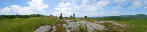
The geology of New Hampshire is diverse and has helped to shape the character of its natural communities. Geologic characteristics have an effect on many factors, such as topography, ground water resources, drainage patterns and mineral resources. The properties of bedrock geology and surficial geology (loose deposits above the bedrock) also strongly influence soil properties and the chemistry of ground- and surface waters. This in turn influences the type of natural communities on the landscape. New Hampshire’s geologic history has left a variety of land features and mineral resources. Plate tectonics contributed to the formation of granite bedrock. Long periods of erosion shaped the hills and mountains. Most recently, repeated glacial activity provided some finishing touches to a land that had been evolving for perhaps 400 million years. Ring dikes indicate past volcanic activity, fault lines demonstrate where the land was uplifted by tremendous forces, and eskers, drumlins, kettleholes, and many other features are evidence of glaciation.
Basic NRI - What to Include:
This information can also be included at a later stage (see Detailed Inventory Studies below).
Detailed Inventory Studies:
An inventory of locally significant geologic features should consider items related to the underlying bedrock and surficial materials that are truly unique on a regional or state-wide basis. Bedrock-related geologic features can include mines, quarries and faults, and calcareous areas that can provide habitat for endangered plant species. Surficial materials include the various soils, gravels, rocks, and other loose materials that lie on top of the bedrock. Some geologic features produced by surficial deposits include drumlins, eskers, kames and kame terraces, and outwash plains. Mapped data for bedrock geology, surficial geology can be found in GRANIT. While this is the best available statewide data, it should be used with caution as it was mapped at a scale of 1:250,000 (i.e., the level of detail is very broad). Other sources of information include the NH Geological Survey office, knowledgeable professionals and members of the community.
Additional Resources:
GRANIT database - Geological and Geophysical section: Includes data for Bedrock Geology, Glacial Features (lines and points) and Surficial Geology. See also GRANITView (Gelogical and Geophysical)
NH Geological Survey (NHDES)