SHARE
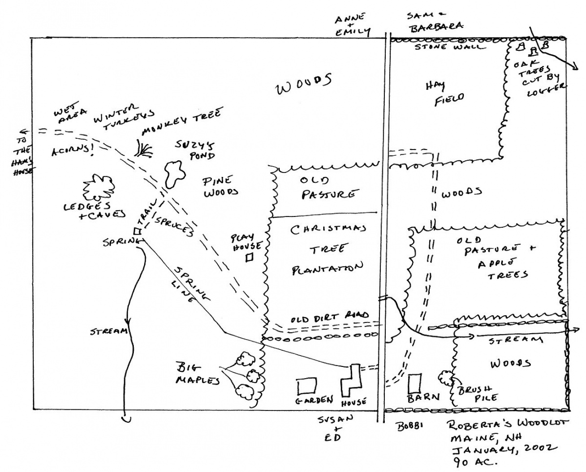
Drawing a map of your property and identifying the approximate locations of features that are important to you may help you learn more about your woodlot. If you wish, use crayons, markers and different colors on your map. Don’t worry about accuracy – this is an exercise to help you think about what is unique, important or what you need to know more about your land. Feel free to share this with your County Forester at UNH Extension and schedule a woodlot visit.
- Start with drawing the approximate shape of your property on a large piece of paper.
- Add roads, trails, ponds, streams, wetlands, fields, forests, hills, and other natural features.
- Show human made features such as houses, cellar holes, old stumps, stonewalls, trails, bridges, etc.
- Highlight the places that are special to you such as a view, special grove of trees, quiet spot, etc.
- Include areas that you use regularly such as maples you tap, the part of the pond used for swimming/fishing, where you snowshoe or walk the dog, your deer stand, etc.
- Show areas where you’ve discovered wildlife or their sign, areas where you have found interesting plants, invasive plants, or features you have questions about.
- Add anything else you want to share.
Contact

Extension State Specialist, Forest Resources
Email: Steven.Roberge@unh.edu
Phone: (603) 862-4861
Office: Barton Hall & Cole Hall, Room C144, Durham, NH 03824