This workshop is no longer taught. Please see the NH Stone Wall Mapping webpage.
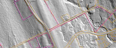
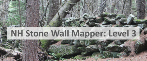
Workshop summary Stone walls have long been considered a part of landscape in New Hampshire, but little is known about the full extent of these relics from our state's past. Now that high resolution of Light Detection and Ranging (LiDAR) imagery is available for the entire state, revealing - among other things - stone walls that are deep within forests, we have the chance to better understand the true geologic and cultural heritage of these structures. An online tool, the NH Stone Wall Mapper, allows anyone to view "hillshade" LiDAR images anywhere in the state and use it to map stone walls that it reveals. This workshop focuses on the use of the NH Stone Wall Mapper to build a GIS database of stone walls throughout the state, including a background on stone walls in NH, LiDAR technology, and how to use the mapper itself.


Participants will learn the basics of stone walls in NH | the basics of LiDAR technology | how to map stone walls in NH
Software discussed NH Stone Wall Mapper
This workshop is no longer taught. Please see the NH Stone Wall Mapping webpage.
Suggested background
none
Suggested next steps

Related Links
Contact

