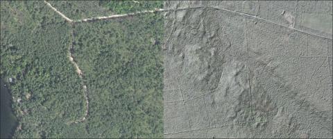
Workshop summary Learn the basics of Light Detection and Ranging (LiDAR) and start making online maps for your projects! LiDAR has the power to peer through the tree canopy to create maps of the ground, stone walls, and structures, as well as, to provide measurements of vegetation height and type. This workshop will cover the basic concepts of using LiDAR for forestry work in New Hampshire, including what data layers are available and how to access them online. Participants will learn how to make and share their own online maps using LiDAR data layers using free online GIS software. No previous GIS experience is required to attend this workshop.


We have no current plans to offer this workshop again soon. If you are interested in possibly enrolling in this workshop, please email Shane Bradt or (call 603) 862-4277.
Participants will learn the basic terminology of LiDAR | the type of data layers LiDAR produces | how to make online maps using LiDAR data layers in NH | how to access NH LiDAR data online
Software discussed GRANITView | ArcGIS Online | NH Stone Wall Mapper
Length 9:00am to 12:00pm
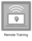
Format REMOTE - students attend via Zoom
Cost $99 standard | $65 reduced remote
Cost note reduced rate applies to educational, non-profit, and governmental
Related Links
Contact

