This workshop is no longer taught. Please see our Getting Started with ArcGIS StoryMaps workshop.
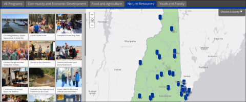
Workshop summary Driven by Esri's ArcGIS Online, Classic Story Maps are a great way to share your information and tell your story to a wide variety of stakeholders! While graphs, charts, PowerPoint presentations, and maps have been commonly used sharing information projects, towns, lakes, etc., interactive visual stories are a more powerful way to engage a range of audiences. Classic Story Maps have dramatically expanded the ability of people to present information in a compelling online format for free (or nearly so) without any coding knowledge.


This workshop focused on helping participants learn how to tell their stories through interactive, photo-based Story Maps, currently the Esri Classic Story Map templates of Map Tour and Shortlist.
Participants will learn to create and edit photo-based Story Maps
Software discussed ArcGIS Online | Classic Story Maps
Templates covered Map Tour | Shortlist
This workshop is no longer taught. Please see our Getting Started with ArcGIS StoryMaps workshop.
Contact
