A Town Wants Visitor Feedback? There's an App for That
Casey Hancock and Geoff Sewake of Cooperative Extension's Community and Economic Development team were in Brattleboro, Vt., researching a secret shopper-style community assessment program called First Impressions. As part of that training, they walked around downtown, recording their impressions using pens and paper booklets.
To Hancock and Sewake, this was a clunky, outdated — and not secretive — way to collect data. First Impressions, which helps communities identify economic strengths and weaknesses through the impressions of first-time visitors, had a lot of potential to help New Hampshire communities, but Hancock and Sewake wanted a more efficient method to collect data. The duo approached Shane Bradt, Cooperative Extension's geospatial technologies specialist, to help develop a mobile data collection app called ArcGIS Collector.
The New Hampshire First Impressions program is supported by a $10,000 grant from the Northeast Regional Center for Rural Development. The grant provided funding for UNH Cooperative Extension in partnership with Extension services from the University of Vermont, West Virginia University, the University of Connecticut, the University of Minnesota and Michigan State University.
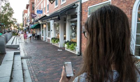
When New Hampshire's First Impressions program kicked-off in Littleton and Rochester in May 2016, program participants used their phones to record their insights discreetly and efficiently. Not only did they collect key data, including photos and videos, they were able to share the information and visualize it on an interactive online map.
"The mobile app made it look more like we were visitors doing what we normally would — taking pictures and using phones," says Christine DeAngelis, Rochester's First Impressions committee chair. "The ability to take and save pictures made it easier to refer back to after the visit and offered more details on our experience."
Jennifer Marsh, Rochester’s economic development specialist, agrees. "The mobile app was not only easy to use but it was more interactive than filling out information in a book," she says. "We could instantly see our results. We covered a lot of ground in a four-hour period."
Beyond being easy to use, the app has also resulted in the collection of more robust data that can be analyzed more effectively. "It was challenging to manage the volume of data," says Hancock. "But the outcome of organizing the data by asset, opportunity and theme is definitely worth it."
She believes the app has had an impact on strengthening the program and its outcomes.
"Groups working on these issues will be able to refer back to the interactive maps we created to examine and visualize where there are clear opportunities for improvement," she says.
Sewake agrees. "The volume of data, and more importantly the ability to effectively analyze it and draw useful conclusions — which is the result of the app — has definitely catalyzed community energy," he says.
This story originally appeared in the 2017 edition of Radius.
Author(s)
